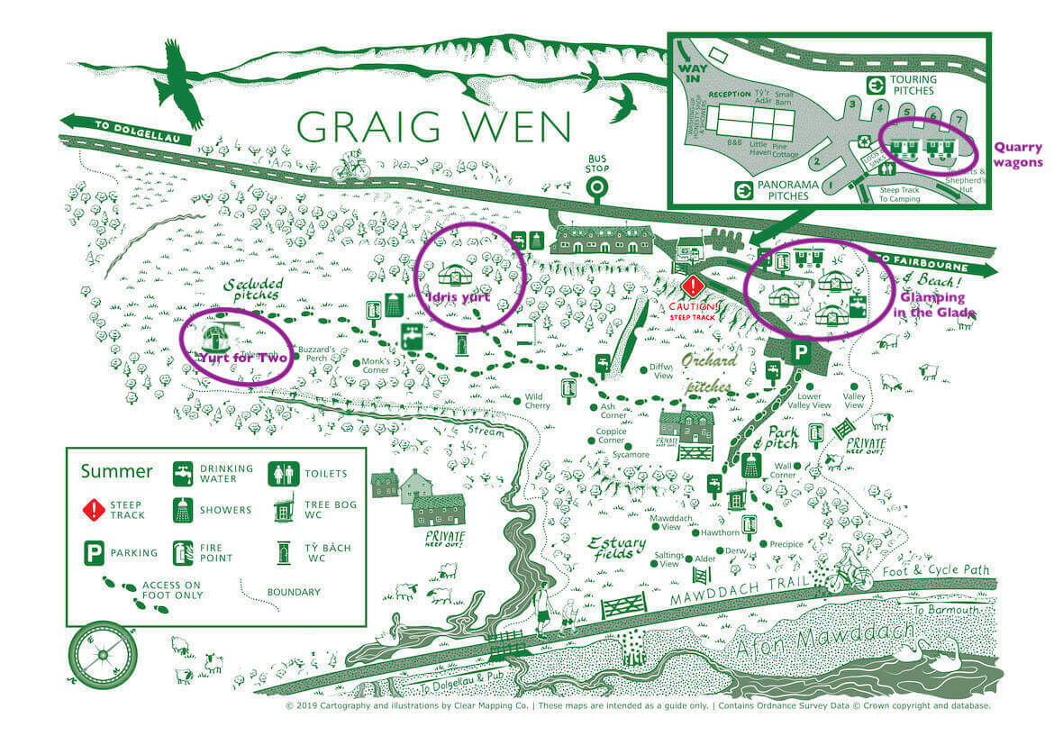
SITE MAPS
Our 45 acre site has various different levels and hidden nooks and crannies. Great to discover – hard to describe! We have made a sketch of the site plan (not to scale!) to help give you an idea of where the various accommodation is. The tent pitches on the lower fields are all named. If you click on the site plan it will enlarge.
The aerial photo of Graig Wen will also enlarge if you click on it. The stone building near the top of the photograph contains the holiday cottages and camp site reception. The touring camp site for vans is on this level. The yurts are in the woods nearby. The car park for the tent camping fields can be seen at the edge of the woods where the fields lead down to the estuary.
Graig Wen is an up and down sort of site with a steep track leading to the Mawddach Trail – read Graig Wen access statement 2022 copy
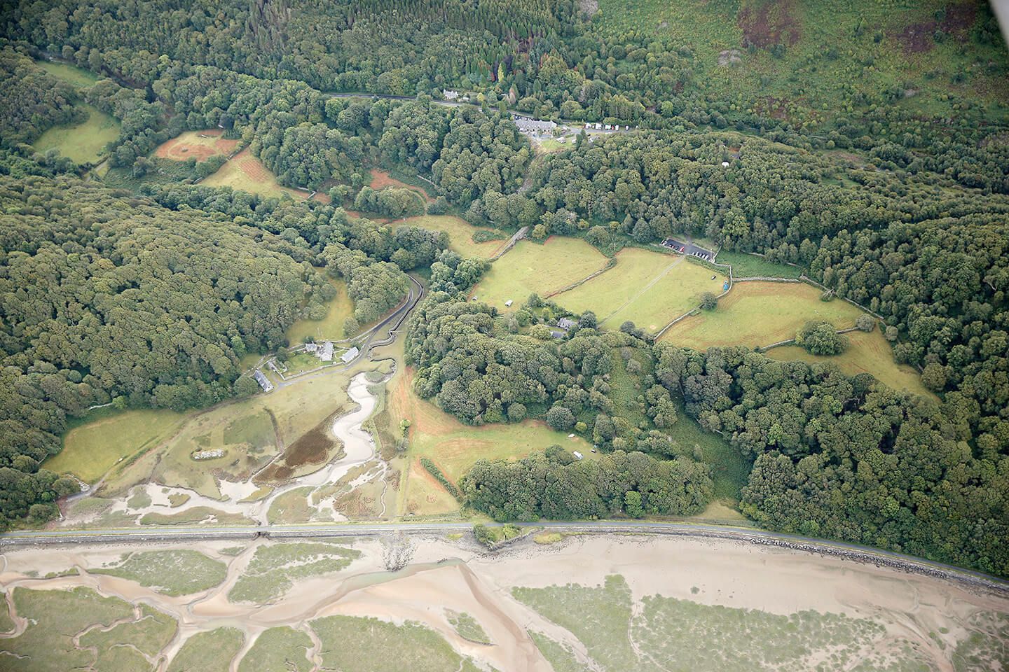
Aerial photo of Graig Wen
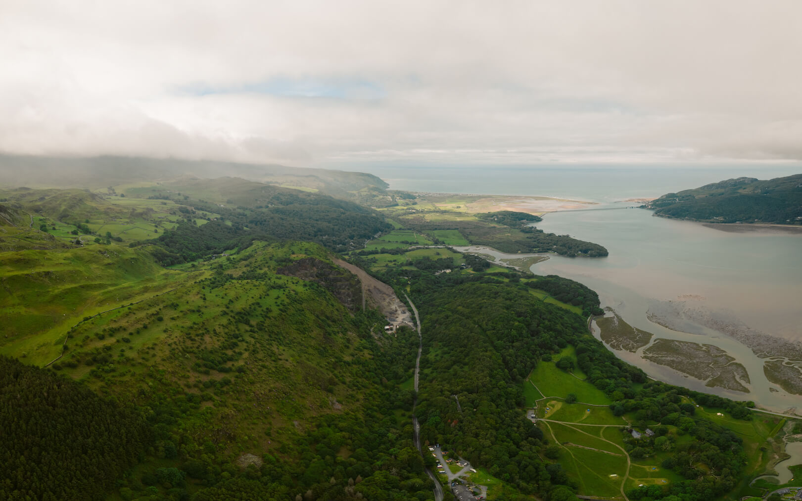
Drone view Graig Wen and Estuary
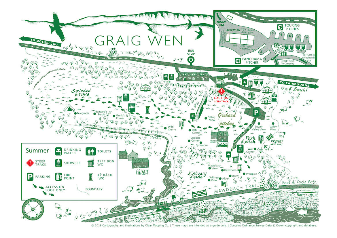
Site Map 2022